Dale Abbey - Part
8 - Around and About
w/e 04 September 2005*
All
this week's pictures were taken with a Kodak DX6490
Page revised 01 February 06
 |
The route of our walk at Dale
Abbey started at the Cat and Fiddle Windmill and once we had
entered the village proper proceeded in a clockwise direction
along Moor Lane, Woodpecker Hill, through Hermit's Wood and into
The Village. This final part of the series returns to a point
about half way round the original route and once again proceeds
in a clockwise direction to see six more locations that are a
little further away from the centre of the village.
|
 |
|
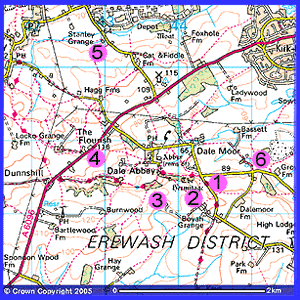
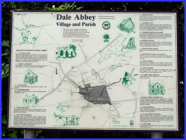
In order, the locations we will visit in this final part are
marked and numbered on this map:
1 - Parsons Piece Field
2 - Potato Pit Lane and Boyah Grange
3 - Dale Abbey Malt House
4 - The Flourish
5 - Baldock Mill
6 - Furnace Pond
|
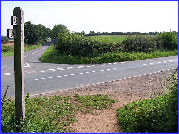
We begin at the point on our original route where we left Woodpecker
Hill to cross the field into Hermit's Wood and here, by balancing
precariously on top of the style into the field, I was able to
turn and look along the lane towards Stanton By Dale. Furnace
Pond which will be the last location in the series (near the
bottom of this page) is about half a mile along this lane and
down a track on the left but we'll start by continuing up Woodpecker
Hill to the right. First though, the reason for me perching on
the style was to look into the field opposite. This is known
as Parsons Piece Field and in the past, the Parson would have
been paid a tythe for the use of it.
|
 Just beyond
the brow of the hill is the location of Potato Pit Lane which
was also known as "Tater 'Ole". This was because there
was a small cavern with a wooden door used for the storage of
potatoes. A profusion of summer growth inhibited locating the
exact position of Potato Pit Lane but I believe it was in the
vicinity of the hedgerow (left) seen here from the road. Crossing
the field via a footpath from the brow leads to Boyah Grange.
Nearby is Boyah Grange Farm which stands on the site of a former
Grange of Dale Abbey and the eighteenth century farmhouse is
within a mediaeval moated enclosure. It is thought that the site
of the former hamlet of Boyah, first recorded in 1160, is in
a field to the immediate north of the farm. Just beyond
the brow of the hill is the location of Potato Pit Lane which
was also known as "Tater 'Ole". This was because there
was a small cavern with a wooden door used for the storage of
potatoes. A profusion of summer growth inhibited locating the
exact position of Potato Pit Lane but I believe it was in the
vicinity of the hedgerow (left) seen here from the road. Crossing
the field via a footpath from the brow leads to Boyah Grange.
Nearby is Boyah Grange Farm which stands on the site of a former
Grange of Dale Abbey and the eighteenth century farmhouse is
within a mediaeval moated enclosure. It is thought that the site
of the former hamlet of Boyah, first recorded in 1160, is in
a field to the immediate north of the farm.
|
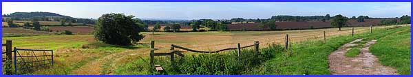
A farm track leads in a short distance to a footpath that continues
in the direction of Ockbrook. The track turns to the right where
a gate bars the way. This panoramic view just does not do justice
to the view from here.
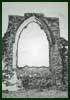
Although there is a prominent sign in the centre of the Village
containing information about the Dale Abbey Malt 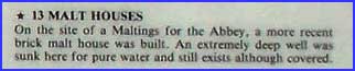 House
including information about a covered well (see right), it should
be noted that the location of the Malt House is actually on private
property. At the request of the owner of the land I have removed
the original image that appeared here of a few bricks of the
building visible through the bushes as it appeared I had strayed
from the public right of way to capture it. It should be noted
that the building dating from the eighteenth century is unstable
and that public access is NOT permitted. Cattle and often
young bulls are grazed on the adjoining land and shooting parties
often operate in the area. House
including information about a covered well (see right), it should
be noted that the location of the Malt House is actually on private
property. At the request of the owner of the land I have removed
the original image that appeared here of a few bricks of the
building visible through the bushes as it appeared I had strayed
from the public right of way to capture it. It should be noted
that the building dating from the eighteenth century is unstable
and that public access is NOT permitted. Cattle and often
young bulls are grazed on the adjoining land and shooting parties
often operate in the area.
You, like I - I am giving a dated copy of this email and details
of your web site to our legal representatives to protect our
interests in these litigious times - have been warned!
|
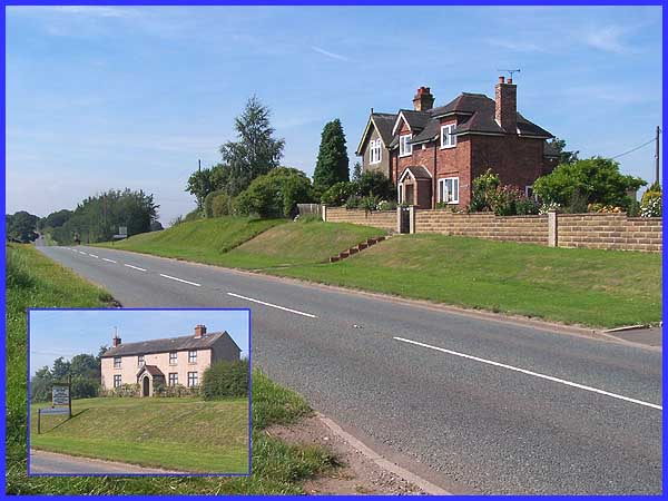
Our next location in our clockwise tour is on the main Ilkeston
to Derby road and is The Flourish so called because the site
"flourished" when coach drivers called in on the old
coaching road for food and a drink. Before the Second World War,
Flourish Farm (inset) which now operates as an antiques business
was an inn called The Stanhope Arms.
|
Moving on to our penultimate location we must head back towards
Ilkeston and turn down Cat and Fiddle Lane by the side of the
windmill where we began this series.  Near the edge of the parish is the site
of Baldock Mill, evidenced by this sign (left) on the wall. Many
people passing by, think that the mill is the building shown
here on the right but this has been converted from Baldock Mill
Cottages. Near the edge of the parish is the site
of Baldock Mill, evidenced by this sign (left) on the wall. Many
people passing by, think that the mill is the building shown
here on the right but this has been converted from Baldock Mill
Cottages. 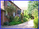 The
site of the mill is actually at the rear of the cottages and
with the kind permission of the owner I was able to capture the
image above. The mill itself stood on the grassy area, the mill
race can still be seen by the fence and the mill pond was up
the bank to the right. The original mill was built in the late
twelfth century by canons of Tupholme whilst in residence at
Dale Abbey and after the dissolution, it was sold and became
known as Baldock Mill in 1555. In the eighteenth and nineteenth
centuries, it was altered and modernised but it had fulfilled
its purpose by the twentieth and was demolished in 1930. Excavations
on the site unearthed the original mill wheel which can now be
seen nearby. The
site of the mill is actually at the rear of the cottages and
with the kind permission of the owner I was able to capture the
image above. The mill itself stood on the grassy area, the mill
race can still be seen by the fence and the mill pond was up
the bank to the right. The original mill was built in the late
twelfth century by canons of Tupholme whilst in residence at
Dale Abbey and after the dissolution, it was sold and became
known as Baldock Mill in 1555. In the eighteenth and nineteenth
centuries, it was altered and modernised but it had fulfilled
its purpose by the twentieth and was demolished in 1930. Excavations
on the site unearthed the original mill wheel which can now be
seen nearby.
|
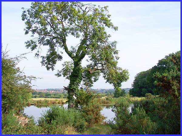
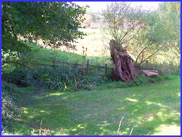
And so we reach our final location, Furnace Pond. Today with
Ilkeston in the distance, this is a quiet and peaceful spot but
it has not always been so. As the name suggests, the pond is
the flooded remains of an old ironstone mine that supplied a
small furnace on the site of Bassett Farm. A footpath from here
goes via the farm to reach the ford that we saw earlier in the
series. The pond is also the scene of an act of bravery that
occurred 100 years ago in 1905. A collier, John Padgett, saved
three people from drowning in one rescue. In conclusion I would
like to thank those who have helped and made this series possible,
in particular the Erewash Groundwork Trust, the Ilkeston &
District Local History Society, Rev. Ruth Allen and of course,
all the people of Dale Abbey.
|
