Nottingham - Along The Banks Of The
Trent
w/e 08 February 2004
This three mile walk follows a route along both sides
of the River Trent as described in "100 Walks In Nottinghamshire"
compiled by Malcolm Sales, first published in 1997 by The Crowood
Press Ltd. I could have chosen many of the images captured during
the walk to illustrate the points of interest and have included
several "film strips" to complement the six main pictures
I did select.
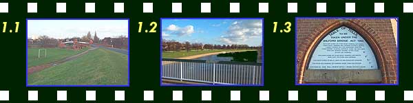
The walk starts on Main Street Wilford close to the Wilford Bridge.
The bridge was closed to motorised traffic in 1974 and has been
rebuilt for pedestrian and cycle traffic only. Embankments (picture
1.1) on each side of Main Street give us our first view of the
bridge, whilst from the bridge itself (1.2) the grassy banks
of Victoria Embankment can be seen on the northern bank of the
Trent. Wilford Bridge was originally built in 1870 as a toll
bridge and was owned and run by the Clifton family until 1969.
A "Table of Tolls" (1.3) with charges ranging from
one old penny for an ass to six pence for a stage coach can still
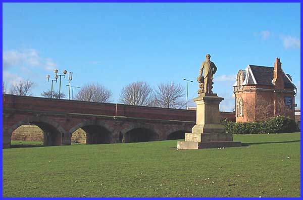
be seen on the northern side of the bridge. A statue of the last
male member of the Clifton family (main picture) stands by the
bridge. Sir Robert Juckes Clifton, Bart. MP died at the age of
99 on May 30, 1869.
|
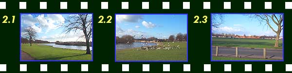
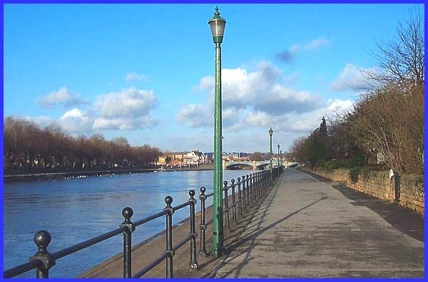
The route now follows the northern bank of the river along the
Victoria Embankment (2.1) for about a mile and a half. This part
of the river is popular with anglers, canoeists and rowers as
well as walkers. It is also popular with a large number of birds
(2.2) who are well looked after and fed by the local populace.
Looking away from the river across the road the city centre can
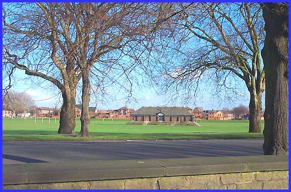
be seen (2.3) and is only a fifteen minute walk away. In the
same direction but only just over the road, are the many pitches
(main picture) where amateur football teams have played for many
years. It was here in the late 1960s and early 1970s in all weathers
that I spent many happy hours with Ilkeston Electric FC. It was
not only the team though that made the headlines as this newspaper
cutting from January 14th 1969 shows.
|
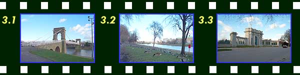
Back on the river side a suspension bridge again, like Wilford
Bridge for pedestrians, crosses the Trent (3.1). Once passed,
the better known Trent Bridge carrying one of the main arterial
routes into the city, comes into view with the green copper roof
of County Hall (3.2) prominent on the opposite bank. But closer
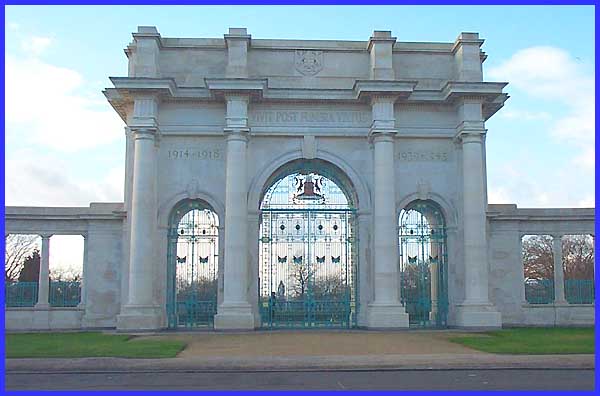
to hand on the left are the Memorial Gardens (3.3). Designed
as a tribute to those who fell in two World Wars and later in
Korea, the gates (main picture) bear the inscription "Virtue
Is Immortal".
|
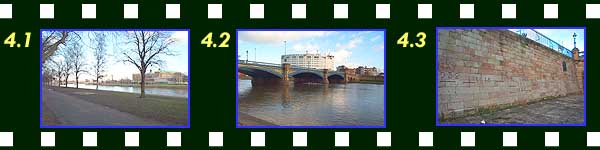
As we approach Trent Bridge passing County Hall on the right
(4.1) a number other familiar landmarks come into view including
the floodlights of the City Ground, home of Nottingham Forest
Football Club and the Rushcliffe Civic Centre (4.2). Just before
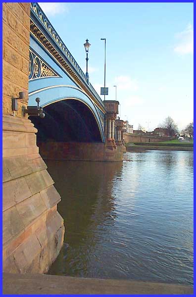
passing under the bridge, the wall has been carved (4.3) with
the high water marks of various floods since 1852, the latest
being added after the flood of November 2000. A wooden bridge
was built here over a thousand years ago and replaced in mediaeval
times by a stone bridge and chapel. The present bridge (main
picture) although extensively modified was constructed in 1870.
|
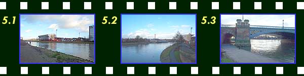
It is here that we leave the north side of the river but not
before looking across, with the anglers, into the City Ground
(5.1). Crossing the bridge we can see the floodlights of Forest's
neighbours, Notts County FC and also a sight that is quite unusual
for a city - the sails of a windmill. Although blending into
the sky in this thumbnail (5.2), I can assure you that Green's
Mill at Sneinton is just to the left of the tree towards the
right of the picture. We now cross under the bridge again (5.3)
where there are still parts of the mediaeval bridge, to commence
the return journey via the river bank on the south side (main
picture).
|
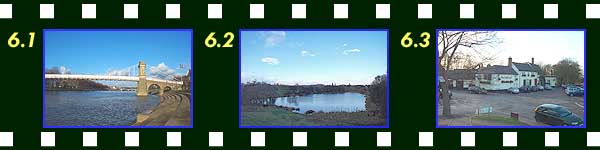
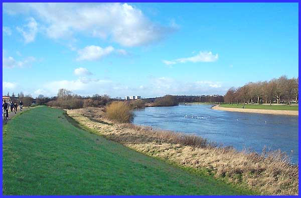
Once more passing the suspension bridge (6.1) the footpath leads
to an alleyway behind some properties where views of the river
are lost before emerging onto an embankment (main picture). As
the river turns northwards, the path continues to the west passing
a pond well known for its wild life (6.2) before reaching the
Ferry Inn (6.3) back on Main Street at Wilford. From here it
is just a short walk northwards to Wilford Bridge and our starting
point.
|
