Derby - Darley Abbey
Part 1
w/e 13 April 2008
All
this week's pictures were taken with a Kodak DX6490
This is the first of three parts following a walk
around the Darley Fields/Darley Abbey area of Derby. Information
about the area is available in leaflets and on the internet detailing
similar but slightly different walks from various starting points
around the area but for our part we'll start and finish at the
Derby Rugby Club on Haslam's Lane and use paths on both sides
of the River Derwent.
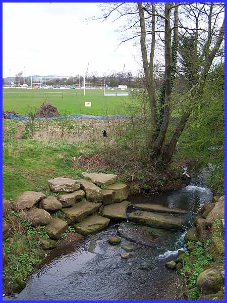
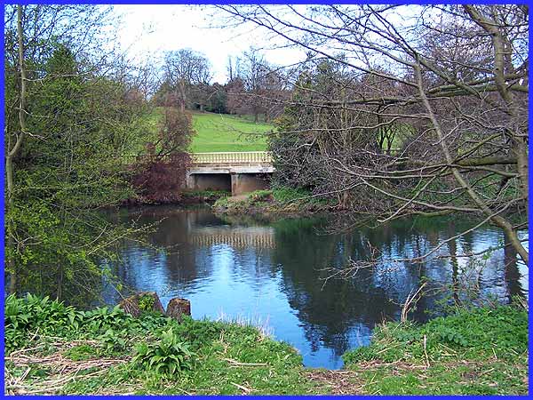
Our route first of all takes us out of the Rugby Club and down
Folly Road to the Folly Road bridge where there is a good view
back to the rugby pitches.
|
The name "Folly" came about because a water mill was
built in the late seventeenth century to the right of this view
of the bridge. Unfortunately the Boar's Head Mill further upstream
had first call on the water and there was insufficient flow here
to operate the mill. The owner sold the building to the proprietor
of the Boar's Head Mill, a Mr. Thomas Evans, who converted it
into three dwellings for his workers. A wooden footbridge shown
on old maps was replaced with a concrete and steel one but erosion
affected the foundations and caused its closure. This more recent
construction leads to the Darley Playing Fields from Folly Road.
|
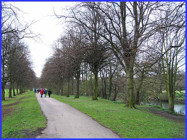
 The path
now follows an avenue of Alder and Sycamore trees at the side
of the River Derwent on its journey south and we follow it as
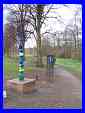
far as a totem pole-like structure (left) where we take the right
hand footpath away from the trees to continue along the river
bank. The last time I featured Darley Playing Fields (to the
left of this picture) on this site was in May 2006 and at that
time the trees were in full leaf. I commented then that the avenue
looked "so different but I can only assume that is because
all of my previous visits were during the winter months."
This picture above, although we are approaching it from the opposite
end, is much more like the mental picture I recalled in 2006. The path
now follows an avenue of Alder and Sycamore trees at the side
of the River Derwent on its journey south and we follow it as
far as a totem pole-like structure (left) where we take the right
hand footpath away from the trees to continue along the river
bank. The last time I featured Darley Playing Fields (to the
left of this picture) on this site was in May 2006 and at that
time the trees were in full leaf. I commented then that the avenue
looked "so different but I can only assume that is because
all of my previous visits were during the winter months."
This picture above, although we are approaching it from the opposite
end, is much more like the mental picture I recalled in 2006.
|
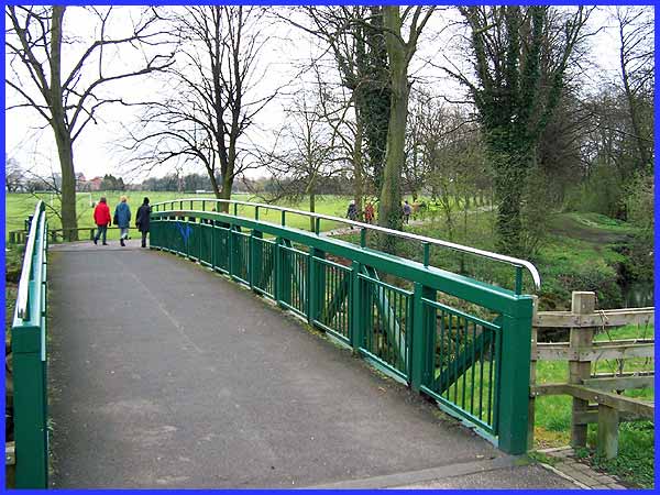
There are plenty of pleasant views across the river to the parkland
that is Darley Abbey Park on the other bank but this is perhaps
one of the most striking where a balustrade has been erected
as a safety feature following (I believe) the installation of
an overflow pipe a few years ago. Before proceeding to the next
picture below you may like to refer back to the previous page
about Darley (click here) for our route passes many of
the features seen there including the tennis courts, bowling
green, wooded area and cricket ground at Parker's Piece.
|
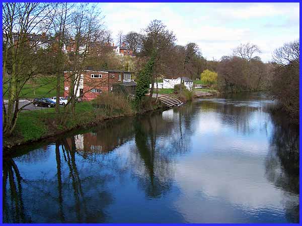
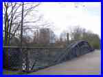 The path
eventually reaches the southernmost point of our walk just beyond
the cricket ground at Handyside's Bridge (left). This was built
in 1878 by Andrew Handyside at the nearby Britannia Foundry and
it carried the Great Northern Railway branch line from Nottingham
Victoria to Egginton Junction until its closure in 1968. It is
but a short walk south from here on the western side of the Derwent
into the city centre but our route is in the opposite direction.
And it is looking to the north from the bridge that we see the
building on the left that is the home of the Derby Rowing Club. The path
eventually reaches the southernmost point of our walk just beyond
the cricket ground at Handyside's Bridge (left). This was built
in 1878 by Andrew Handyside at the nearby Britannia Foundry and
it carried the Great Northern Railway branch line from Nottingham
Victoria to Egginton Junction until its closure in 1968. It is
but a short walk south from here on the western side of the Derwent
into the city centre but our route is in the opposite direction.
And it is looking to the north from the bridge that we see the
building on the left that is the home of the Derby Rowing Club.
|
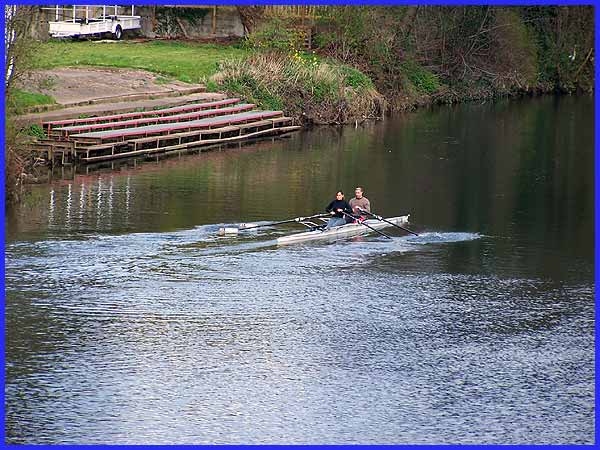
Back in 2006 I wrote that I saw neither rowers nor cricketers
but on this occasion, groundsmen were preparing the cricket pitch
for the forthcoming season and a couple of rowers pulled out
from the Rowing Club and headed off upstream. With the benefit
of the zoom lens this image was also captured from Handyside's
Bridge.
|
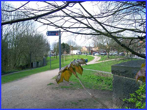
As we leave the bridge, a signpost indicates the way to the city
centre and the path ahead forks to the left and right. As already
indicated our route is to the right where we will follow a track
known as Darley Grove.
|
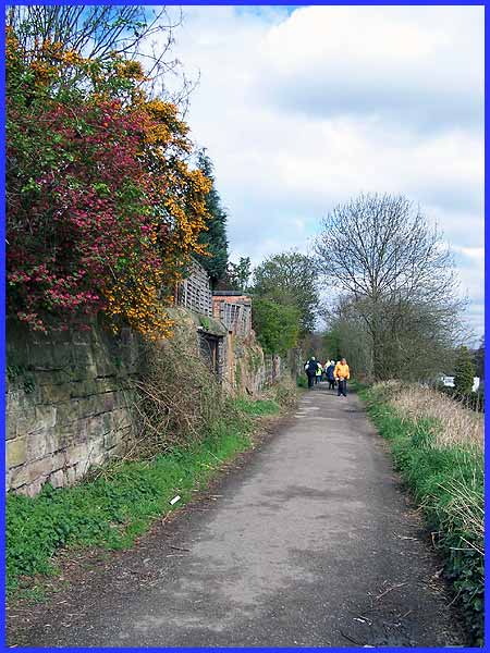
A notice at the end of Darley Grove states that it is unsuitable
for motor vehicles but a number of garages are built into the
hillside which suggests that at least some vehicles travel along
here.
|
