Ilkeston - Bridges
w/e 08 January 2017
All of this week's pictures were
taken with a Kodak DX6490
There have been temporary signs at the island at the northern
end of Chalons Way for several months now indicating the the
road is closed at the railway bridge on Awsworth Road and traffic
has been diverted along Rutland Street and Millership Way. Similar
signs are in place at the end of Newtons Lane where it meets
the Awsworth bypass. I decided to go and have a look.
|
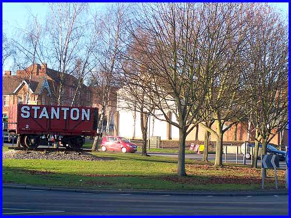
Instead of walking down Granby Street and Awsworth Road I opted
to go along Rutland Street for the more scenic route to the Erewash
Canal across what forever will be what locals call Johnnies although
it is officially known as Wash Meadows. Millership Way is to
the left.
|
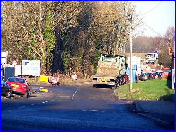
Traffic along the diverted route is heavy at the moment and supplemented
by more vehicles using the road instead of the Station Road route
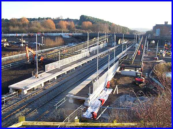
because of the ongoing works associated with the construction
of Ilkeston's new railway station. The station was due to be
operational by December but access still needs to be made to
the platforms from the Station Road railway bridge. The bridge
will be closed over four weekends in January which will only
serve to increase Millership Way/Rutland Street traffic even
more.
|
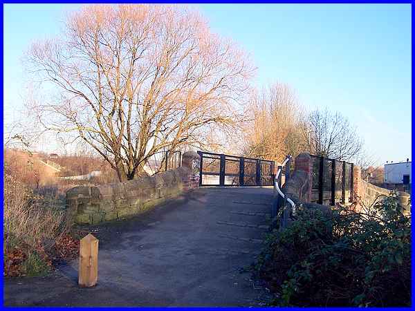
I'd left Johnnies to walk along Millership Way to view the new
station but returned and crossed the footbridge over the canal
to gain access to the towpath contemplating all the way that
if a relatively small project could be beset by so many difficulties,
miss target dates and be over budget, what hope is there for
a major project like the planned HS2 construction.
|
From the canal footbridge the towpath can be seen passing under
the Millership Way bridge and that is the way I went to Awsworth
Road.
|
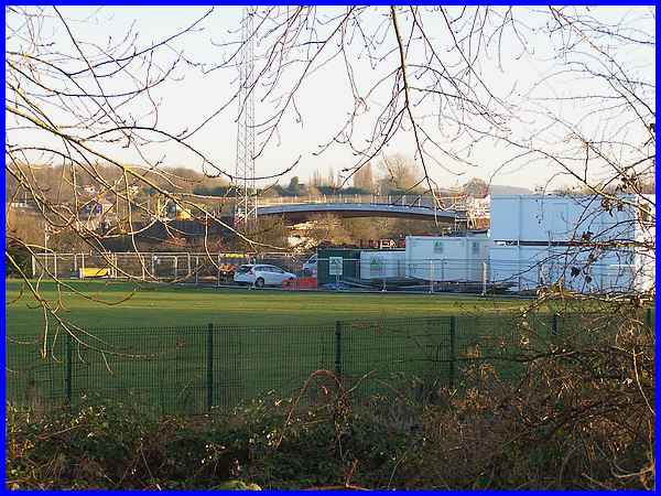
From the bridge over the canal at Awsworth Road I looked past
Ilkeston FC's ground towards the railway bridge where construction
work was obviously in progress. Additional "Road Closed"
signs and heavy vehicles bore testimony to the work.
|
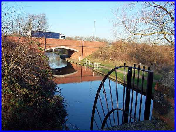
I continued along the towpath to Stenson's Lock which provided
a good vantage point to view the reason for the road closure
which is given as "To facilitate reconstruction of railway
bridge, including works to both approaches." The work is
scheduled to take place between September 2016 and March 2017.
|
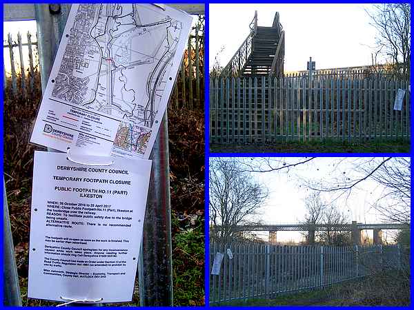
I carried on passing the end of the Bennerley Viaduct then made
a short detour from the towpath to climb the old footbridge over
the railway line hoping to get a good shot of the viaduct from
the steps. That was not to be as a fence has been erected preventing
access to the bridge so the only shot available of the structure
was from ground level. A map and notice on the fence disclosed
that the bridge was unsafe, the path was closed and there was
no alternative route.
|
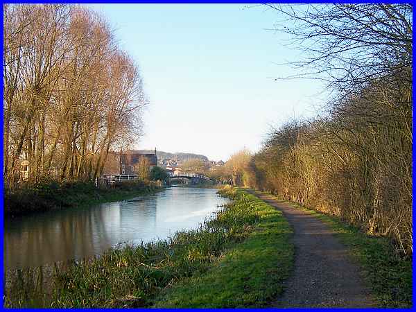
Thwarted I returned to the canal and as I had come this far decided
to continue to the next canal bridge which is at the bottom of
Bridge Street in Cotmanhay and can be seen from close to where
I returned to the towpath spanning the water.
|
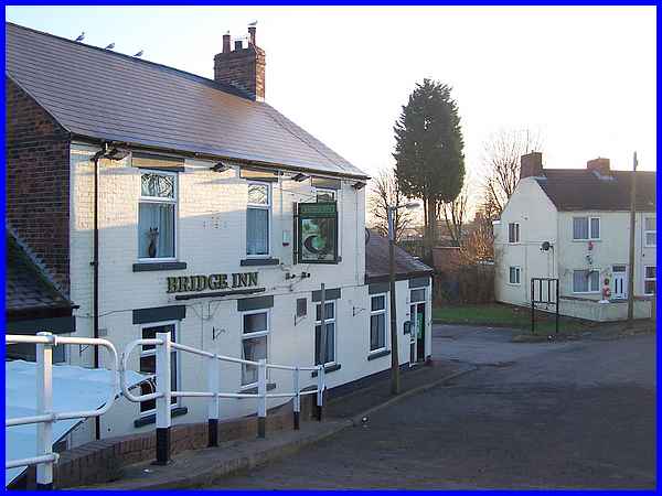
The building adjacent to the bridge and seen from it is of course,
the Bridge Inn. From here I walked to the other end of Bridge
Street and waited for a bus to take me back home. In total I
had walked about 3.5 miles but the section from Rutland Street
to Bridge Street including the detours to the new station and
the viaduct measures about 2.2 miles. See a map of the route
at mapometer.com.
|
