Autumn Footprints 2018 - Week One
w/e 23 September 2018
All of this week's pictures were
taken with a Kodak DX6490
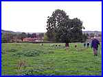
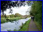
Of the guided walks available in the first week of the Festival,
I joined the groups for five of them beginning with a seven mile
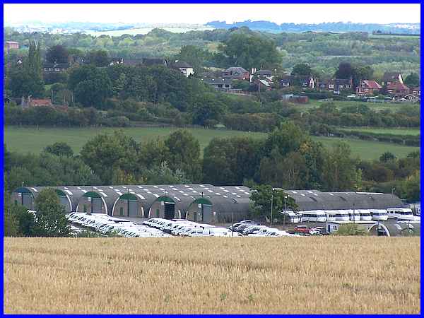
route on Monday around West Hallam and Stanley through countryside
like that shown above. The walk was led by the Heanor Local History
Society and facts were related at various points on the route.
For example the old buildings seen here at the West Hallam Storage
Depot were used during World War II and they are still in use
today although there are also more modern buildings on the huge
site.
|
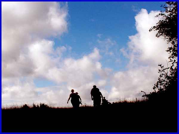
As we climbed to the highest point in the walk near the Cat and
Fiddle Windmill the walkers in front appeared in silhouette against
the sky. The conditions varied throughout the walk but much of
it was conducted under skies like this - typical autumn weather
that is usually guaranteed for the annual Festival.
Route Map
|
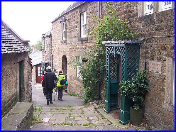
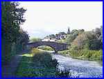
History was a theme of several of the walks during the week not
least among them a gentle wander around Crich with the Amber
Valley Walking For Health group on Tuesday. The route took us
up Bown's Hill and Cromford Road with several stops along the
way to point out many of the historical buildings. George Stephenson,
the "Father of Railways", built a mineral railway in
Crich and entertained his guests in the Wheatsheaf pub. This
was just one of the stops on the way.
|
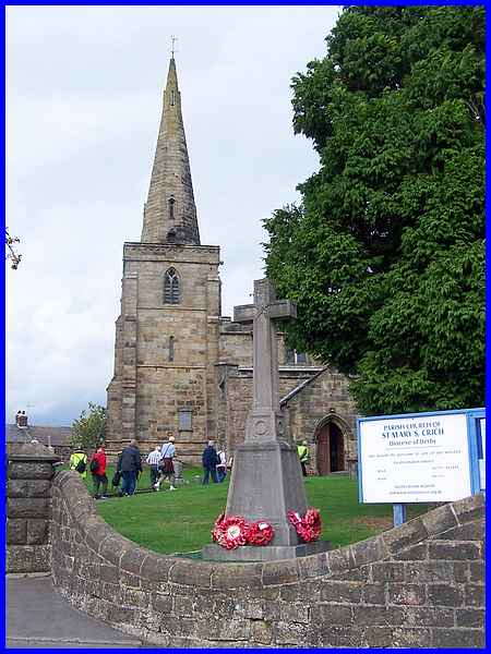
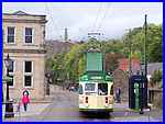 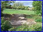 Another pause
in the walk was at St Mary's Church where again there were many
interesting features and items pointed out inside. From there
we continued up to the National Tramway Museum (left) built in
a former quarry before returning to the village centre across
the fields. It was here that a stone slab where the surrounding
vegetation had been cleared was identified as Holy Well (right). Another pause
in the walk was at St Mary's Church where again there were many
interesting features and items pointed out inside. From there
we continued up to the National Tramway Museum (left) built in
a former quarry before returning to the village centre across
the fields. It was here that a stone slab where the surrounding
vegetation had been cleared was identified as Holy Well (right).
Route Map
|
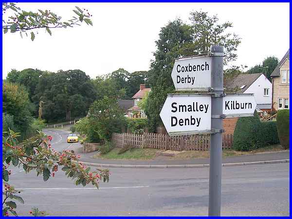
On Wednesday I joined a party of walkers from the Horsley Woodhouse
Walking for Health group for a three mile walk at Horsley Woodhouse
and Horsley. This signpost in Horsley opposite the Coach and
Horses pub shows the roads to nearby villages (and Derby) but
most of this walk was on footpaths over open countryside.
|
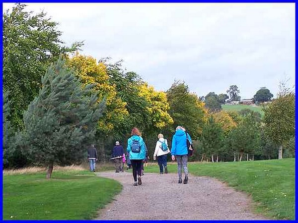
 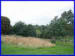 We had reached Horsley mainly on footpaths
(left) and our return to Horsley Woodhouse included a section
across the Horsley Lodge Golf Course where signs of autumn were
apparent in the trees. This was a very similar route to last
year's Autumn Footprints walk about the same time but the season
seems more advanced this year. Compare the same wildflower area
(right) with this photo from last year. We had reached Horsley mainly on footpaths
(left) and our return to Horsley Woodhouse included a section
across the Horsley Lodge Golf Course where signs of autumn were
apparent in the trees. This was a very similar route to last
year's Autumn Footprints walk about the same time but the season
seems more advanced this year. Compare the same wildflower area
(right) with this photo from last year.
Route Map
|
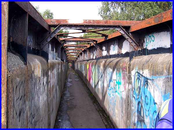
It's not only history that featured large in my itinerary for
this first week of the Festival but also Walking for Health groups
as it was another one I joined on Friday for the Sandiacre Strollers'
"Sandiacre and Stanton Gate Loop". Although mainly
a waterside walk it did include crossing this long graffiti covered
footbridge over the railway into Stapleford and showed another
aspect of the sights to be seen in the Festival.
|
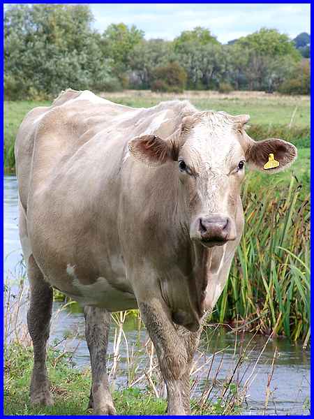
  The
route had begun at Sandiacre Library and continued along the
Erewash Canal as far as a bridge over it (left) before turning
off to cross the railway bridge. It returned from the north to
the same bridge (right) and retraced the route back to the library.
In between it was mainly road walking but the route did pass
through a field full of cattle including ear tagged no. 401728
standing by the River Erewash. The
route had begun at Sandiacre Library and continued along the
Erewash Canal as far as a bridge over it (left) before turning
off to cross the railway bridge. It returned from the north to
the same bridge (right) and retraced the route back to the library.
In between it was mainly road walking but the route did pass
through a field full of cattle including ear tagged no. 401728
standing by the River Erewash.
Route Map
|
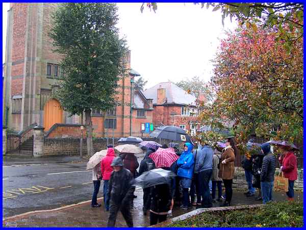
It was back to the history walks on Saturday when a higher than
expected number braved the elements for a "Step Through
Time in Ilkeston" led by volunteers from the Erewash Museum.
Again frequent stops were made in the one and a half mile route
to discover the history of some of the buildings. Here on Wharncliffe
Road, three buildings - the United Reformed Church (1905), the
Red House (1899) and Croft House (1926) - were all designed by
Ilkeston architect Harry Tatham Sudbury.
|
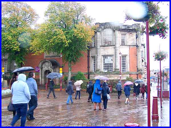
Another stop on the walk was the "Carnegie Free Library"
which was opened by the Duke of Rutland in 1904. With the rain
still pouring down more buildings in the town centre were visited
including Rutland Mills, St Mary's Church and the Town Hall but
it's fair to say not as many people concluded the walk back to
the Erewash Museum than started from there.
Route Map
On Saturday evening something I cannot remember ever happening
before took place. Due to the weather forecast, Sunday's walks
were cancelled with one of them being rescheduled for the following
week. As it turned out Sunday wasn't bad at all but at least
there was the chance to dry out and prepare to week two of the
Festival.
|
