The Whittlestone Walk - Part 04
w/e 04 March 2012
All this week's pictures were taken
with a Kodak DX6490
At the end of Part 03 I commented that we had started
this walk under autumn skies and continued into the winter months.
In Part 03A we briefly returned to the summer of 2008 and as
we complete this final section we are quickly heading towards
spring. So it was on a bright afternoon that we made our way
down the lane from the Newdigate Inn at West Hallam to resume
where Part 03A finished.
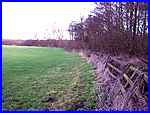
  Where the
lane bends on its way to The Brook, it is crossed by the footpath
from Mapperley Lane and it is here (left) that we picked up that
path to access some raised ground (right) running behind and
parallel to the cottages at The Brook. From this elevated position
our outward route can be seen where Head House Farm stands on
the brow of the hill with the Slack Lane railway bridge also
visible towards the left. Where the
lane bends on its way to The Brook, it is crossed by the footpath
from Mapperley Lane and it is here (left) that we picked up that
path to access some raised ground (right) running behind and
parallel to the cottages at The Brook. From this elevated position
our outward route can be seen where Head House Farm stands on
the brow of the hill with the Slack Lane railway bridge also
visible towards the left.
|
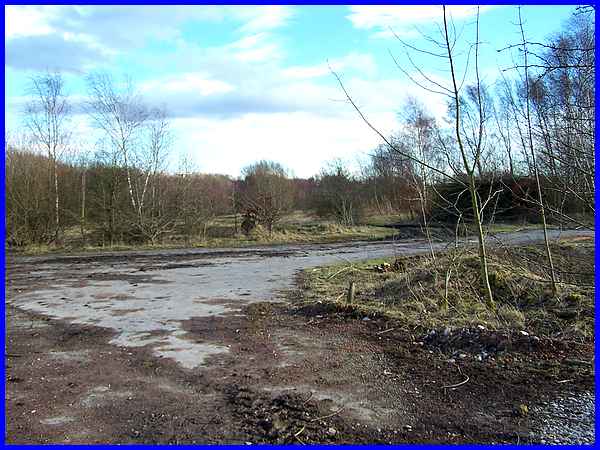
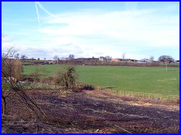
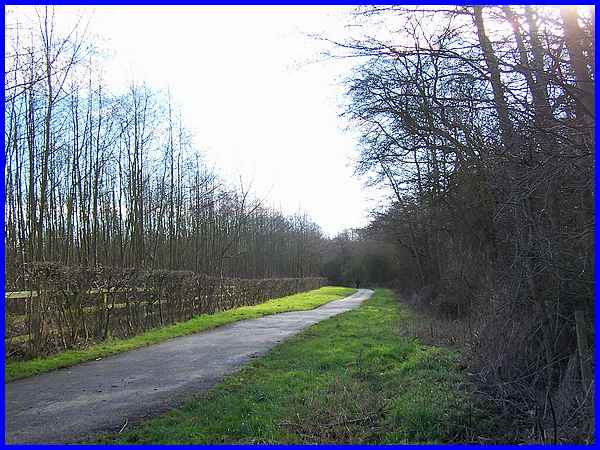
As might be expected in this area where coal mining was once
an important industry, the raised ground we are walking along
is actually the route of a former mineral railway line. To the
right of the raised ground, there is a large area of desolate
and derelict land that is slowly being reclaimed by nature. This
was a former industrial complex, part of which was used to screen
opencast coal during and after the Second World War and if memory
serves correctly continued until well into the 1960s and perhaps
even longer.
|
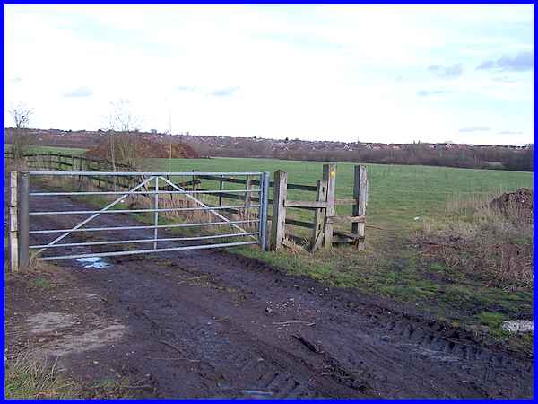
The out-of-date leaflet that we are following describing the
Whittlestone Walk is correct in saying that the track leads to
a stile on the left. Here it continues "Cross stile into
field" but in truth the passage of time and the absence
of a fence means that it is now much easier to walk around the
stile to enter the field.
|
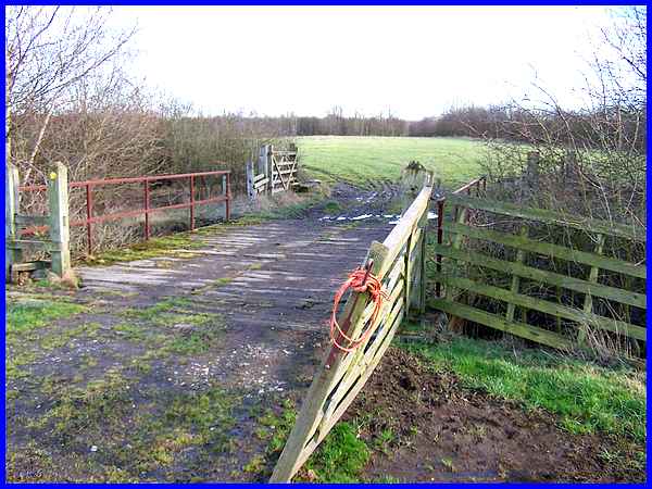
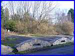
  Turning
immediately to the right on entering the field, there is little
or no sign of a footpath but a waymarker points the way, keeping
the wood on the right (left and right) towards the bridge (above)
over the Nut Brook . This is the same bridge we crossed on the
outward journey but instead of continuing back along the field
opposite, our route now is to turn right over another stile and
by the side of the brook. Turning
immediately to the right on entering the field, there is little
or no sign of a footpath but a waymarker points the way, keeping
the wood on the right (left and right) towards the bridge (above)
over the Nut Brook . This is the same bridge we crossed on the
outward journey but instead of continuing back along the field
opposite, our route now is to turn right over another stile and
by the side of the brook.
|
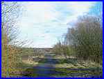
A short section of a muddy path emerges onto the much better
surfaced Nutbrook Trail. The Trail runs from Heanor to Long Eaton
and this part we are now on near Ilkeston follows the line of
the former Nutbrook Canal. The four and a half mile canal opened
in 1796 and carried coal from Shipley southwards to the ironworks
at Stanton and beyond. The coming of the railways contributed
to its demise and it fell into disuse in 1949.
|
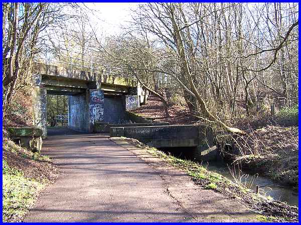
The canal has now all but disappeared but the Nut Brook still
runs alongside the Trail and if you know where to look among
the undergrowth near to where the Trail passes under another
old railway bridge there is still evidence of one of the thirteen
locks on the canal.
|
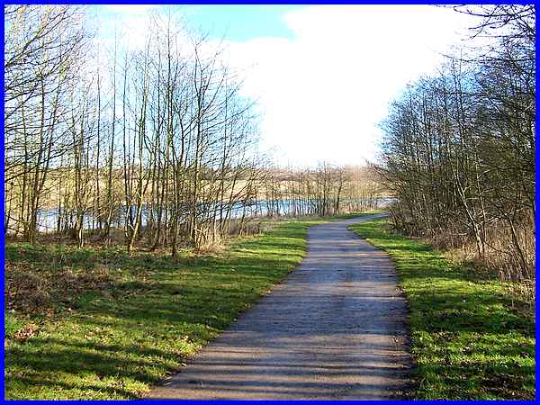
After passing under the bridge with the brook still on the right
there is a large expanse of water on the left. This is the Manner
Floods lake. From here there are a number of paths that can be
followed back to Victoria Park but the map included in the leaflet
shows the route continuing around the southern side of the lake
so that is the option we took.
|
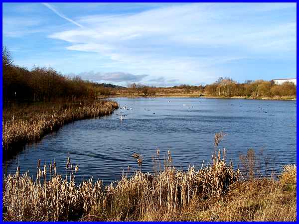
The lake at Manner Floods is popular with anglers and together
with the surrounding area forms an important habitat and haven
for wildlife. The area has currently also been identified as
one of two possible development sites for some seven hundred
houses here and another five hundred at Quarry Hill. Unsurprisingly
and with some justification these proposals have led to the formation
of Action and Protest Groups.
|
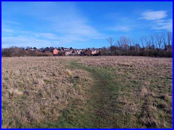
Numerous footpaths across the grassland lead back into Ilkeston,
the houses in the distance being built in recent years on land
previously used as allotment gardens. It really would be a travesty
if this easily accessible open green space for residents of the
town that provides so much to so many was lost to developers.
|
Skirting the Pewit Golf Course and crossing over the Manners
Link footpath again, there are again a variety of routes to follow
either through the housing estate or as we chose, along a footpath
between the houses and the former Ilkeston School, now the Ormiston
Academy, to emerge on Drummond Road opposite our staring point
in Victoria Park.
The Whittlestone Walk is five miles in length but with the diversions
to Holy Trinity Church in Mapperley and Mapperley Castle the
route followed is nearer to five and a half. Click here to see a map view of the whole
route. Most of the images were captured between November 2011
and February 2012 with a few more in Part 03A dating from May
2008 and you can see them all again plus a few extra in this
YouTube
video presentation.
|
