The Coffin Walk - Part 01
w/e 18 March 2012
All this week's pictures were taken
with a Kodak DX6490
 Despite its rather
forbidding name, the Coffin Walk is a pleasant circuit from Breaston
towards Wilne which then circles Draycott and returns to Breaston
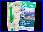
via the route of the former Derby Canal. A leaflet published
in March 2000 was updated and reissued in a new slimmer format
by Groundwork Derby and Derbyshire in 2011. Both versions (left)
describe the route which is about five miles in length and include
a map as well as information about various points of interest
on the way. Despite its rather
forbidding name, the Coffin Walk is a pleasant circuit from Breaston
towards Wilne which then circles Draycott and returns to Breaston
via the route of the former Derby Canal. A leaflet published
in March 2000 was updated and reissued in a new slimmer format
by Groundwork Derby and Derbyshire in 2011. Both versions (left)
describe the route which is about five miles in length and include
a map as well as information about various points of interest
on the way.
 We have walked the route several
times previously and in both clockwise and anti-clockwise directions
usually as part of a group during the Autumn Footprints Walking
Festival each September. For the purposes of this series, we
will follow the clockwise directions as described in the leaflets
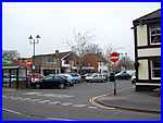
beginning at The Green (right) in the centre of Breaston. The
Green is actually a car park with a two hour time limit but as
the leaflets advise allowing up to three hours to complete the
walk, motorists need to find alternative parking in the village
or make use of the frequent bus service that passes through.
Or, as we are doing, walk it in stages .... We have walked the route several
times previously and in both clockwise and anti-clockwise directions
usually as part of a group during the Autumn Footprints Walking
Festival each September. For the purposes of this series, we
will follow the clockwise directions as described in the leaflets
beginning at The Green (right) in the centre of Breaston. The
Green is actually a car park with a two hour time limit but as
the leaflets advise allowing up to three hours to complete the
walk, motorists need to find alternative parking in the village
or make use of the frequent bus service that passes through.
Or, as we are doing, walk it in stages ....
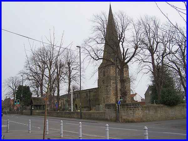
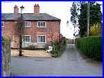 Directly across
from The Green is St Michael's Church. The church dates from
the early thirteenth century and was probably originally built
in the reign of King John. Originally it was a "Chapel of
Ease" to nearby Sawley and only mass was said in the church.
This meant that other services such as weddings, baptisms and
funerals had to be conducted in St Chad's Church at Wilne. It
also meant that coffins had to be carried across the fields to
Wilne along the route which now forms the first part of our walk
and which gave rise to the name of the Coffin Walk. We begin
the walk by the side of the church in Church View (right). Directly across
from The Green is St Michael's Church. The church dates from
the early thirteenth century and was probably originally built
in the reign of King John. Originally it was a "Chapel of
Ease" to nearby Sawley and only mass was said in the church.
This meant that other services such as weddings, baptisms and
funerals had to be conducted in St Chad's Church at Wilne. It
also meant that coffins had to be carried across the fields to
Wilne along the route which now forms the first part of our walk
and which gave rise to the name of the Coffin Walk. We begin
the walk by the side of the church in Church View (right).
There is a full history of the church on the St Michael's Church website.
|
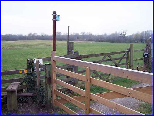
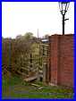
Although we start in the centre of the village we are immediately
in the open countryside after climbing the stile at the bottom
of Church View. This is the first of five stiles within the first
half mile or so.
|
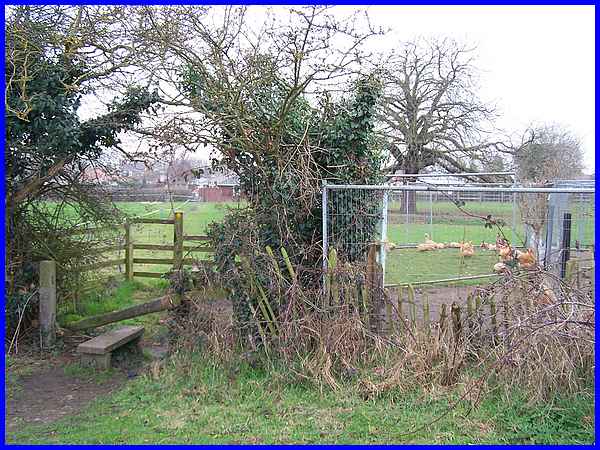
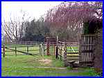
The second stile is actually a double stile through the hedge
into the next field. Although there is open countryside to the
left, the path runs along the boundaries of the properties in
Breaston and to the right there are gardens, orchards and even
enclosures for poultry.
|
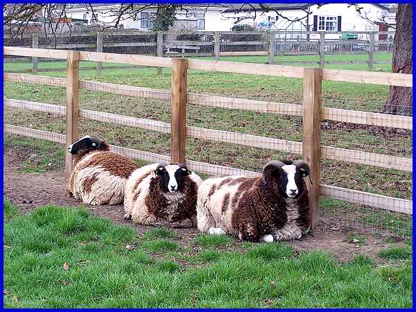
And against the fence bounding the next field we passed three
Jacob sheep that were huddled together and gave us nothing more
than an inquisitive glance.
|
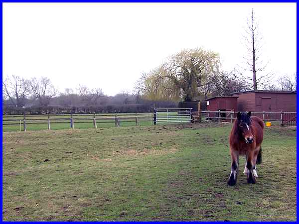
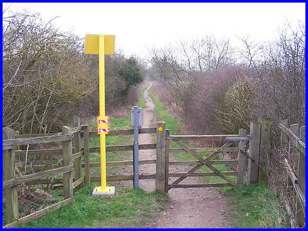
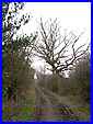
  The animal life continued in the next field
after crossing the third stile (left) where the diagonal route
was patrolled by this pony who stood like an equine guardian
of the footpath. As he was not going to move we detoured around
him and continued to the fifth stile (right) and onto a bridleway
used not only by pedestrians but also by horseriders and cyclists
too. The thought crossed my mind that if these stiles were in
situ when the coffins were carried this way there must have been
a lot of stops and starts. The animal life continued in the next field
after crossing the third stile (left) where the diagonal route
was patrolled by this pony who stood like an equine guardian
of the footpath. As he was not going to move we detoured around
him and continued to the fifth stile (right) and onto a bridleway
used not only by pedestrians but also by horseriders and cyclists
too. The thought crossed my mind that if these stiles were in
situ when the coffins were carried this way there must have been
a lot of stops and starts.
|
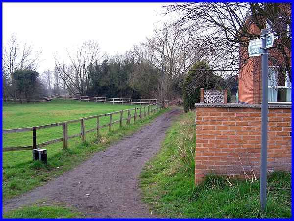
  So in less than half a mile we've already
seen a variety of animals and clambered over five stiles but
there is an alternative beginning to this walk that misses all
of those. That is via Marlborough Avenue from the bottom of which
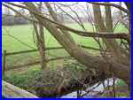
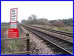
the bridleway can be joined. The bridleway swings round to the
left, crosses a brook (left) to reach the railway line (right)
where the leaflets warn to "Beware of Trains!" So in less than half a mile we've already
seen a variety of animals and clambered over five stiles but
there is an alternative beginning to this walk that misses all
of those. That is via Marlborough Avenue from the bottom of which
the bridleway can be joined. The bridleway swings round to the
left, crosses a brook (left) to reach the railway line (right)
where the leaflets warn to "Beware of Trains!"
|
After carefully crossing the railway lines the path continues
to the southwest between hedges on both sides. On the left a
bank rises behind the hedge to obscure the view of Church Wilne
Reservoir. Construction of the reservoir and treatment works
began in 1967 as part of a Derwent Valley scheme to take about
six million gallons of water a day from the River Derwent to
supply Nottingham.
|
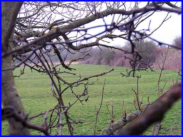
To the right of the path and seen with some difficulty through
the hedge is a feature that goes back way beyond 1967 to mediaeval
times with an excellent example of a ridge and furrow open field
system.
|
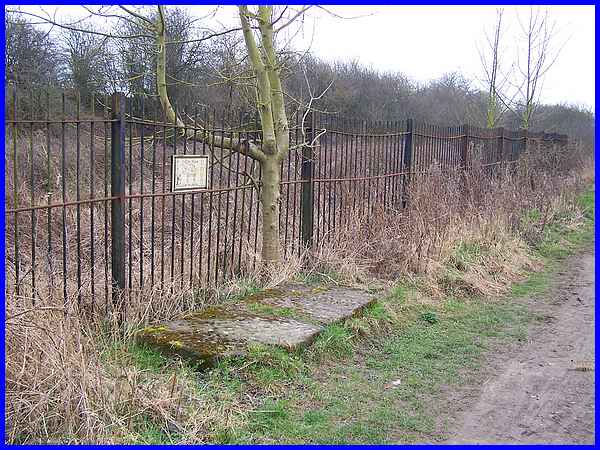
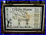 A
little way after the railway crossing a plaque is fixed to the
fence above a large broken stone slab. The plaque is headed "Coffin
Stone" and alongside the illustrations relates how coffins
had to be carried along the "Coffin Walk" or "Corpse
Way"to St Chad's prior to the consecration of St Michael's
in 1824. It continues: "Coffin Stones provided somewhere
for the coffin to be placed whilst the bearers paused on the
two mile journey. Historically located near here, and originally
in one piece, this stone is believed to have been the top slab
of one such temporary resting place." A
little way after the railway crossing a plaque is fixed to the
fence above a large broken stone slab. The plaque is headed "Coffin
Stone" and alongside the illustrations relates how coffins
had to be carried along the "Coffin Walk" or "Corpse
Way"to St Chad's prior to the consecration of St Michael's
in 1824. It continues: "Coffin Stones provided somewhere
for the coffin to be placed whilst the bearers paused on the
two mile journey. Historically located near here, and originally
in one piece, this stone is believed to have been the top slab
of one such temporary resting place."
|
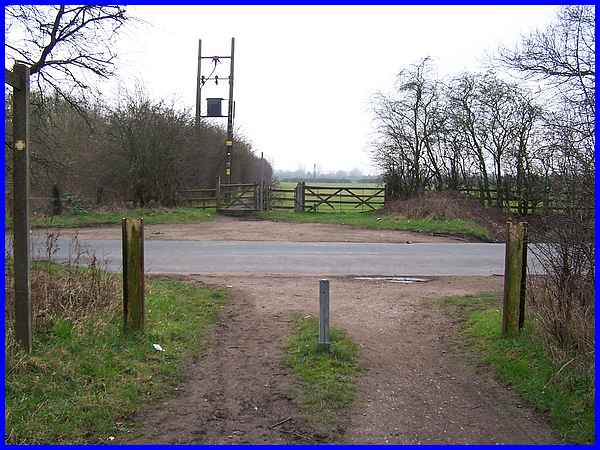
  After
the Coffin Stone the bridleway (left) continues towards Church
Wilne and in about three quarters of a mile from the start of
the walk reaches Sawley Road (right) at a place called Wilne
Cross. I regret that I have been unable to determine whether
the name just refers to the crossing of the road by the bridleway
or whether an ancient cross once stood here. I suspect the latter
as the name "Wilne Cross" appears on maps although
I have yet to find any evidence of such on the ground. After
the Coffin Stone the bridleway (left) continues towards Church
Wilne and in about three quarters of a mile from the start of
the walk reaches Sawley Road (right) at a place called Wilne
Cross. I regret that I have been unable to determine whether
the name just refers to the crossing of the road by the bridleway
or whether an ancient cross once stood here. I suspect the latter
as the name "Wilne Cross" appears on maps although
I have yet to find any evidence of such on the ground.
|
